Let every American, every lover of liberty, every well wisher to his posterity, swear by the blood of the Revolution, never to violate in the least particular, the laws of the country; and never to tolerate their violation by others.
As the patriots of seventy-six did to the support of the Declaration of Independence, so to the support of the Constitution and Laws, let every American pledge his life, his property, and his sacred honor; let every man remember that to violate the law, is to trample on the blood of his father, and to tear the charter of his own, and his children's liberty.
Let reverence for the laws, be breathed by every American mother, to the lisping babe, that prattles on her lap; let it be taught in schools, in seminaries, and in colleges; let it be written in Primers, spelling books, and in Almanacs; let it be preached from the pulpit, proclaimed in legislative halls, and enforced in courts of justice. And, in short, let it become the political religion of the nation; and Let the old and the young, the rich and the poor, the grave and the gay, of all sexes and tongues, and colors and conditions, sacrifice unceasingly upon its altars.
While ever a state of feeling, such as this, shall universally, or even, very generally prevail throughout the nation, vain will be every effort, and fruitless every attempt, to subvert our national freedom.
- Abraham Lincoln, January 27, 1838 Address Before the Young Men's Lyceum of Springfield, Illinois
America will never be destroyed from the outside. If we falter and lose our freedoms, it will be because we destroyed ourselves. - Abraham Lincoln
I do the very best I know how - the very best I can; and I mean to keep doing so until the end. If the end brings me out all right, what's said against me won't amount to anything. If the end brings me out wrong, ten angels swearing I was right would make no difference. - Abraham Lincoln
Every man is said to have his peculiar ambition. Whether it be true or not, I can say for one that I have no other so great as that of being truly esteemed of my fellow men, by rendering myself worthy of their esteem. - Abraham Lincoln
I freely acknowledge myself the servant of the people, according to the bond of service - the United States Constitution; and that, as such, I am responsible to them. - Abraham Lincoln
If all men were just, there still would be some, though not so much, need of government. - Abraham Lincoln
The power confided to me will be used to hold, occupy, and possess the property and places belonging to the government, and to collect the duties and imposts; but beyond what may be necessary for these objects, there will be no invasion, no using of force against or among the people anywhere. - Abraham Lincoln
To sin by silence when they should protest makes cowards of men. - Abraham Lincoln
Force is all-conquering, but its victories are short-lived. - Abraham Lincoln
Kings had always been involving and impoverishing their people in wars, pretending generally, if not always, that the good of the people was the object. - Abraham Lincoln
Peace is a thing which a person must be willing to fight for. - Abraham Lincoln
I appeal to all loyal citizens to favor, facilitate and aid this effort to maintain the honor, the integrity, and the existence of our National Union, and the perpetuity of popular government; and to redress wrongs already long enough endured. - Abraham Lincoln
My dream is of a place and a time where America will once again be seen as the last best hope of earth. - Abraham Lincoln
While the people retain their virtue, and vigilance, no administration, by any extreme of wickedness or folly, can very seriously injure the government, in the short space of four years. - Abraham Lincoln
I care not much for a man's religion whose dog and cat are not the better for it. - Abraham Lincoln
The world has never had a good definition of the word liberty, and the American people, just now, are much in want of one. - Abraham Lincoln
Labor is prior to, and independent of, capital. Capital is only the fruit of labor, and could never have existed if labor had not first existed. Labor is the superior of capital, and deserves much the higher consideration. - Abraham Lincoln
There is more involved in this contest than is realized by every one. There is involved in this struggle the question whether your children and my children shall enjoy the privileges we have enjoyed. - Abraham Lincoln
My great concern is not whether you have failed, but whether you are content with your failure. - Abraham Lincoln
Public sentiment is everything. With public sentiment, nothing can fail; without it, nothing can succeed. - Abraham Lincoln
You can fool all the people some of the time, and some of the people all the time, but you cannot fool all the people all the time. - Abraham Lincoln
Allow the president to invade a neighboring nation, whenever he shall deem it necessary to repel an invasion, and you allow him to do so whenever he may choose to say he deems it necessary for such a purpose - and you allow him to make war at pleasure. - Abraham Lincoln
I laugh because I must not cry. That is all. That is all. - Abraham Lincoln
I have borne a laborious, and, in some respects to myself, a painful part in the contest. Through all, I have neither assailed, nor wrestled with any part of the constitution. - Abraham Lincoln
We must not promise what we ought not, lest we be called on to perform what we cannot. - Abraham Lincoln
It often requires more courage to dare to do right than to fear to do wrong. - Abraham Lincoln
Determine that the thing can and shall be done, and then we shall find the way. - Abraham Lincoln
I am a firm believer in the people. If given the truth, they can be depended upon to meet any national crisis. The great point is to bring them the real facts. - Abraham Lincoln
When I do good, I feel good. When I do bad, I feel bad. That is my religion. - Abraham Lincoln
Be sure you put your feet in the right place, then stand firm. - Abraham Lincoln
If once you forfeit the confidence of your fellow-citizens, you can never regain their respect and esteem. - Abraham Lincoln
I am in favor of animal rights as well as human rights. That is the way of a whole human being. - Abraham Lincoln
I had been told I was on the road to hell, but I had no idea it was just a mile down the road with a dome on it. - Abraham Lincoln
These capitalists generally act harmoniously and in concert, to fleece the people. - Abraham Lincoln
With malice toward none, with charity for all, with firmness in the right as God gives us to see the right, let us strive on to finish the work we are in, to bind up the nation's wounds, to care for him who shall have borne the battle and for his widow and his orphan, to do all which may achieve and cherish a just and lasting peace among ourselves and with all nations. - Abraham Lincoln
There are no accidents in my philosophy. Every effect must have its cause. The past is the cause of the present, and the present will be the cause of the future. All these are links in the endless chain stretching from the finite to the infinite. - Abraham Lincoln
Let no feeling of discouragement prey upon you, and in the end you are sure to succeed. - Abraham Lincoln
He has a right to criticize, who has a heart to help. - Abraham Lincoln
You cannot escape the responsibility of tomorrow by evading it today. - Abraham Lincoln
I could not have slept tonight if I had left that helpless little creature to perish on the ground. - Abraham Lincoln (Reply to friends who chided him for delaying them by stopping to return a fledgling to its nest.)
You cannot help small men by tearing down big men. - Abraham Lincoln
Worse than traitors in arms are the men who pretend loyalty to the flag, feast and fatten on the misfortunes of the Nation, while patriotic blood is crimsoning the plains. . . and their countrymen moldering the dust. - Abraham Lincoln
Any people anywhere, being inclined and having the power, have the right to rise up, and shake off the existing government, and form a new one that suits them better. This is a most valuable - a most sacred right - a right, which we hope and believe, is to liberate the world. - Abraham Lincoln
Don't interfere with anything in the Constitution. That must be maintained, for it is the only safeguard of our liberties. - Abraham Lincoln
Nearly all men can stand adversity, but if you want to test a man's character, give him power. - Abraham Lincoln
No man is good enough to govern another man without that other's consent. - Abraham Lincoln
Our defense is in the preservation of the spirit which prizes liberty as a heritage of all men, in all lands, everywhere. Destroy this spirit and you have planted the seeds of despotism around your own doors. - Abraham Lincoln
Our safety, our liberty, depends upon preserving the Constitution of the United States as our fathers made it inviolate. The people of the United States are the rightful masters of both Congress and the courts, not to overthrow the Constitution, but to overthrow the men who pervert the Constitution. - Abraham Lincoln
I am not bound to win, but I am bound to be true. I am not bound to succeed, but I am bound to live by the light that I have. I must stand with anybody that stands right, and stand with him while he is right, and part with him when he goes wrong. - Abraham Lincoln
We are not enemies, but friends. We must not be enemies. Though passion may have strained it must not break our bonds of affection. The mystic chords of memory, stretching from every battlefield and patriot grave to every living heart and hearthstone all over this broad land, will yet swell the chorus of the Union, when again touched, as surely they will be, by the better angels of our nature. - Abraham Lincoln
A house divided against itself cannot stand. - Abraham Lincoln
I have never had a feeling, politically, that did not spring from the Declaration of Independence, that all should have an equal chance. This is the sentiment embodied in the Declaration of Independence. I would rather be assassinated on this spot than surrender it. - Abraham Lincoln
The possibility that we may fail in the struggle ought not to deter us from the support of a cause we believe to be just. - Abraham Lincoln
The dogmas of the quiet past, are inadequate to the stormy present. The occasion is piled high with difficulty, and we must rise -- with the occasion. As our case is new, so we must think anew, and act anew. We must disenthrall ourselves, and then we shall save our country. - Abraham Lincoln
I have always found that mercy bears richer fruits than strict justice. - Abraham Lincoln
I see in the near future a crisis approaching that unnerves me and causes me to tremble for the safety of my country. Corporations have been enthroned and an era of corruption in high places will follow, and the money power of the country will endeavor to prolong its reign by working upon the prejudices of the people until all wealth is aggregated in a few hands and the Republic is destroyed. - Abraham Lincoln
Tuesday, April 28, 2009
Looking back at Lincoln: On April 18, 1863
On this day in 1863, Lincoln wrote the following memorandum concerning one Francis Capen, who claimed to be a "Certified Practical Meteorologist—& Expert in Computing the Changes of the Weather."
It seems to me Mr. Capen knows nothing about the weather, in advance. He told me three days ago that it would not rain again till the 30th. of April or 1st. of May. It is raining now & has been for ten hours. I can not spare any more time to Mr. Capen.
A LINCOLN
I can certainly identify with this entry.
Before the Civil War, the Army Corps of Engineers was already gathering and using weather data. When the war began - and after seeing the impact of weather on troop marches (mud) and battles (wind and rain) - battlefield commanders requested accurate weather forecasts so they could better plan their movements.
Without any legitimate meteorologists (Francis Capen appears to have been a crank,) the Army gathered weather data as best as they could, and transmitted it by telegraph (i.e. 'its raining here and the wind appears to be blowing in your general direction.') Of course this wasn't a terribly accurate way to gather and distribute weather data, but it was better than nothing.
This fledgling system evolved into the National Weather Bureau, which eventually became the National Weather Service. Now we have satellites and radar... but we here in Indiana can testify: they still get it wrong much of the time!
Poor Cuba... they are once again taking the full brunt of a major hurricane. They withstood Ivan as a Cat 5, Gustav as a Cat 4, and apparently Ike rolled in as a Cat 3 packing waves five stories high.
Somehow they manage to avoid hurricane related deaths, even when they take a direct hit from a Category 5 storm. We could have learned a lot about hurricane preparedness from Cuba pre-Katrina.
But of course, we don't talk to Cuba.
The country that really appears to need assistance right now - from within and undoubtedly from a hurricane-ready country like Cuba - is Haiti. They were sacked first by Gustav, and then (without any time to recover,) by Ike. The Haitian death count from these two storms is horrific.
PORT-AU-PRINCE (AFP) — With severe flooding, hundreds dead and hundreds of thousands lacking food and basic provisions, Haiti has been hit badly so far this hurricane season, with four severe storms in less than four weeks.
The Caribbean nation has suffered more than its neighbors, also lashed by major storms, in part because of severe deforestation and extreme poverty.
After Tropical Storm Fay and Hurricane Gustav in August, the poorest country in the Americas was devastated by Tropical Storm Hanna last week, and flooding was compounded Saturday night and Sunday when Hurricane Ike clipped the country's northern peninsula as it raged westward toward Cuba.
Damaged infrastructure and continuing rains left aid organizations struggling to bring emergency assistance to hundreds of thousands of storm victims.
About 600 people died in Haiti's recent storms, according to UN and government figures, and one million were affected. The storms also battered roads and bridges.
Our own media is rather quiet about the ongoing plight of suffering Haitians. Even the Weather Channel tracks a hurricane while it is pounding on one of our neighbors - and they are our neighbors - and considers only the potential landfall on our Gulf Coast (and this is the very attitude that causes everyone to hate Americans.)
But we're not all so self-absorbed. I care, so I'm posting this AP clip.
Meet Ike.
Ike hammering Cuba and Haiti
If you have any trouble with the sound on this video, please click here.
I'm so sorry... for your seemingly endless suffering. Every single storm that has hammered, us, Michigan, Wisconsin, Kentucky... they all hit you first.
Those who cannot learn from history are doomed to repeat it. - George Santayana
Our current and very severe drought in Southern Indiana has for some reason made me think about the Dust Bowl days. The dust storms of the 30s began with intense heat... and drought. And the heat and the drought grew worse and worse, until the soil blew away.
Perhaps it is the sight of the huge, jagged cracks I see opening in my front yard... under the dry moss, beneath the yellowing trees. This is supposed to be a humid, damp area; we usually have big 'elephant ear' plants growing all across the forest floor at this time of the year, not dry crackling leaves and brown, dying plants.
And the dirt... is turning to dust.
As I walk across the increasingly common dry patches in the yard, little plumes of dust rise where my feet have tread... and I think of the dust storms that swept through Oklahoma, and swept away everything in their path: an entire way of life.
Our Local Drought
Perhaps my unease began when I saw large, jagged cracks opening in our front yard... under the now dry, brown moss, beneath the strangely yellowing trees. This is supposed to be a humid, damp area; we usually have big 'elephant ear' plants growing all across the forest floor at this time of the year, not dry crackling leaves and brown, dying plants.
And the dirt... is turning to dust.
Our region is extremely dependent on adequate rainfall; the survival of the wide variety of deciduous trees for which this area is famous (especially in Autumn,) depends on the rain from winter storms and summer thundershowers. Usually the forest floor is very lush and green at this time of the year.
But now the forest is dry and parched; the forest floor brown and dead. Leaves are turning prematurely yellow, the days are searingly hot without a cloud, anywhere in the sky, across the entire state. There seldom any rain in the forecast these days, and when storms do come into the area, they mysteriously slide to the north.
We have already lost some rather large saplings on our property; beautiful trees that towered over my head, but simply couldn't compete for groundwater with the larger trees beside them. Older trees seem to be withstanding the drought pretty well, but even medium-sized trees are now showing signs of stress; their leaves prematurely yellow. Some trees are also starting to show signs of disease and frequent attacks by insect pests. And when I drive into town, dead trees and plants now line the roadside.
We are having the worst drought in decades, after having the wettest winter in, well, decades. It is hotter than Hades most days, with strange dips in temperature at night (sometimes into the 40s.)
Add these to the increasingly long list of unusual weather occurrences in the past 12 months. We lost our fruit crop to a late, long freeze this spring (which wiped out the blossoms, and our winter wheat along with them.) The winter was so warm and wet that we saw swarms of mosquitoes on New Year's Day.
To experience all of these weather oddities within the same calendar year is unnerving. Record rainfall... followed immediately by drought? Climate change isn't a theory here; we can see it happening all around us, every day, as we scan the sky for any sign of rain.
About 40 percent of the state is in a “D2” stage of severe drought, National Weather Service meteorologist Logan Johnson said. That determination is made by the weather service along with other agencies such as the U.S. Department of Agriculture and fire and weather agencies, he said. They’re looking at things such as the amount of rain, the status of deep groundwater wells and soil moisture for the weekly rating.
Why isn’t it raining? Persistent upper level high pressure systems are keeping away the cold fronts that are necessary for rain. That makes precipitation spotty, Johnson said. For example, they’ve had reports of rain in the northern half of a county but none in the southern.
“The ridge is just so strong it keeps that weather pattern,” he said. “And Indiana drought years typically come with this same weather pattern.”
'Wacky weather,' flooding and large areas of drought now affect much of the country, from California and Arizona through the Midwest and South. While some portions of the country are receiving so much rain that they have experienced record flooding, other areas are parched with ever-worsening drought.
And sometimes the difference between the two extremes is a single county.
To give you an idea of how crazy the weather has been across the Midwest this summer, here is some recent data from NOAA.
The current drought report from southern Ohio, from NOAA:
HYDROLOGIC OUTLOOK NATIONAL WEATHER SERVICE WILMINGTON OH 605 PM EDT THU AUG 30 2007
...EXTREME DROUGHT CONDITIONS NOW EXPANDING INTO KENTUCKY AND SOUTHERN OHIO...WITH SEVERE DROUGHT CONDITIONS OVER SOUTHEAST INDIANA...
...VERY LITTLE CHANCE OF RAIN IN THE FORECAST...
ESPECIALLY IN AREAS NEAR THE OHIO RIVER...AUGUST HAS BEEN A RECORD SETTING MONTH FOR TEMPERATURE. THE CINCINNATI/NORTHERN KENTUCKY AIRPORT HAS SET A NEW RECORD FOR MOST DAYS IN A MONTH AT OR ABOVE 90 DEGREES. THERE HAVE BEEN 25 DAYS OF 90 DEGREE OR WARMER HIGH TEMPERATURES AT CINCINNATI...INCLUDING 5 DAYS WHICH HAVE REACHED AT LEAST 100 DEGREES. THIS HAS BEEN COMBINED WITH ONLY 0.53 INCHES OF RAIN FOR AUGUST...WHICH IS 3.03 INCHES BELOW NORMAL.
SUCH EXTREME CONDITIONS HAVE RESULTED IN AN INTRODUCTION OF D3...OR EXTREME DROUGHT...INTO FAR SOUTHERN OHIO AND NORTHERN KENTUCKY. WITH LITTLE TO NO RAIN IN THE FORECAST OVER THE NEXT 7 DAYS...THE D3 CATEGORY WILL LIKELY EXPAND FURTHER WEST INTO INDIANA NEXT WEEK.
WHILE NORTHERN OHIO AND INDIANA EXPERIENCED RECORD FLOODING OVER THE PAST TWO WEEKS...MANY AREAS SOUTH OF DAYTON AND COLUMBUS RECEIVED LITTLE TO NO RAINFALL.
OHIO CORN CROPS ARE EXPECTED TO YIELD ABOUT 20 TO 30 PERCENT LESS THAN NORMAL...ACCORDING TO THE OHIO STATE UNIVERSITY EXTENSION OFFICE. MUCH OF THESE DECLINES ARE DUE TO DROUGHT IN SOUTHERN OHIO... THOUGH SOME WILL BE A RESULT OF THE RECENT FLOODING IN NORTHERN OHIO. GENERALLY FROM 20 TO 25 PERCENT OF OHIO`S SOYBEAN AND CORN CROPS ARE RATED POOR TO VERY POOR CONDITION. ACROSS KENTUCKY...25 PERCENT OF CORN AND NEARLY 40 PERCENT OF SOYBEAN CROPS WERE REPORTED IN POOR TO VERY POOR CONDITION.
RAINFALL DEFICITS IN THE EXTREME DROUGHT AREA IS AS MUCH AS 12 TO 16 INCHES BELOW NORMAL FOR THE YEAR...WITH MOST LOCATIONS GENERALLY 8 TO 12 INCHES BELOW NORMAL FOR THE YEAR. EVEN WITH NORMAL RAINFALL THROUGH THE END OF 2007...THE CINCINNATI AREA WILL LIKELY FINISH WITHIN THE TOP TEN DRIEST YEARS ON RECORD.
STATISTICS FOR THE 3 MAJOR REPORTING STATIONS ARE LISTED BELOW:
THERE ARE THREE MAJOR CLIMATE STATIONS IN THE REGION: PORT COLUMBUS AIRPORT...DAYTON INTERNATIONAL...AND CINCINNATI/NORTHERN KENTUCKY. BELOW ARE THE OBSERVED RAINFALL VALUES AND THE DEPARTURE FROM NORMAL SINCE MAY 1...WHEN THE RAINFALL DEFICIT LARGELY BEGAN.
FOR CINCINNATI...DAYTON AND COLUMBUS...THE RAINFALL IS AS FOLLOWS:
STATION         SINCE MAY 1        INCHES BELOW NORMAL
CINCINNATI          5.12                 11.32
DAYTON             10.33                  5.19
COLUMBUS           11.93                  4.26
Meanwhile, Kentucky is experiencing record heat:
From NOAA:
RECORD EVENT REPORT NATIONAL WEATHER SERVICE LOUISVILLE KY 945 AM EDT SAT SEP 1 2007
...LOUISVILLE KENTUCKY BREAKS SEVERAL MORE RECORDS IN AUGUST 2007...
THE AVERAGE TEMPERATURE OF 85.0 DEGREES SET FOR AUGUST 2007 AT THE LOUISVILLE INTERNATIONAL AIRPORT SHATTERS THE OLD RECORD OF 83.0 PREVIOUSLY SET IN 1936.
THE 85.0 DEGREES ALSO MAKES IT THE HOTTEST MONTH EVER IN LOUISVILLE HISTORY...TOPPING THE PREVIOUS HIGH OF 84.2 DEGREES SET FOR JULY 1901.
And of course, Indiana:
THE NATIONAL WEATHER SERVICE ISSUES THESE HYDROLOGIC OUTLOOK STATEMENTS ANY TIME A PORTION OF THE AREA IS CATEGORIZED AS SEVERE DROUGHT CONDITIONS...WHICH IS QUANTIFIED AS CATEGORY D2 ON THE DROUGHT MONITOR MAP. LOCALLY...THERE HAS BEEN WORSENING SINCE LATE MAY OVER THE REGION...WITH THE MOST EXTREME PRECIPITATION DEFICITS OVER SOUTHERN OHIO...NORTHERN KENTUCKY AND SOUTHEAST INDIANA.
LOOKING AT OTHER INDICATORS...MUCH OF THE UNREGULATED STREAMFLOW ACROSS SOUTHEAST INDIANA...NORTHERN KENTUCKY AND SOUTHERN AND WESTERN OHIO ARE RUNNING IN THE 10TH TO 24TH PERCENTILE. THIS DATA IS REPORTED BY THE US GEOLOGICAL SURVEY.
MOST AREA WATER SUPPLY RESERVOIRS AND WELL LEVELS WERE RUNNING TYPICALLY ABOUT ONE FOOT BELOW NORMAL...BUT HARSHA LAKE ON THE EAST FORK OF THE LITTLE MIAMI WAS RUNNING 5 FEET BELOW THE NORMAL SUMMER POOL LEVEL.
FOR THE NEXT WEEK OVER THE IMPACTED AREA...LITTLE TO NO RAINFALL IS FORECAST. ONLY A SLIGHT POSSIBILITY OF RAIN IN THE FORM OF ISOLATED SHOWERS AND THUNDERSTORMS IS EXPECTED DURING THE MIDDLE OF NEXT WEEK. WHILE A SLIGHTLY BETTER CHANCE FOR RAIN IS EXPECTED IN THE 8 TO 14 DAY PERIOD...THIS TOO WILL LIKELY BE IN THE FORM OF SCATTERED SHOWERS AND THUNDERSTORMS.
And while the southern counties of Indiana are parched, and our trees are dying, the northern part of Indiana was flooding only a week ago:
RECORD EVENT REPORT NATIONAL WEATHER SERVICE NORTHERN INDIANA 0830 AM EDT SAT SEP 1 2007
...RECORD MONTHLY RAINFALL SET AT SOUTH BEND...
8.88 INCHES OF RAINFALL WAS RECORDED AT SOUTH BEND FOR THE MONTH OF AUGUST. THIS BREAKS THE OLD RECORD OF 8.30 INCHES SET IN 1979.
FOR SOUTH BEND THIS RANKS AS THE 7TH WETTEST MONTH ON RECORD AND BRINGS THE SUMMER TOTALS TO THE 4TH WETTEST EVER ON RECORD.
TEMPERATURE WISE THIS RANKED AS THE 13TH WARMEST AUGUST ON RECORD.
...MISCELLANEOUS RECORDS FOR FORT WAYNE...
9.69 INCHES OF RAINFALL WAS RECORDED AT FORT WAYNE FOR THE MONTH OF AUGUST. THIS RANKS AS THE SECOND WETTEST AUGUST ON RECORD AND WAS THE 5TH WETTEST MONTH EVER ON RECORD.
So no... we don't believe in climate change here in the Midwest, can't imagine why we would. We're much more likely to believe ExxonMobile and Bush.
All sarcasm aside, one has to wonder. Are we headed back in time? If these crazy weather patterns continue (and they show no signs of ever returning to normal,) can we even survive here? Can we grow food? Will we have enough drinking water?
Can it happen again?
So what caused the Dust Bowl in the 1930s? NASA scientists think they may now know the answer to that question... but we won't like it. Turns out only a slight change in sea temperature can cause a shift in the jet stream, which affects whether we get normal rainfall, droughts or flooding. And we already have both higher ocean temperatures and a shift in jet stream.
Scientists at NASA's Goddard Space Flight Center recently used a computer model and satellite data to examine climate over the past century. In the study, cooler than normal tropical Pacific Ocean temperatures and warmer than normal tropical Atlantic Ocean temperatures created ideal drought conditions due to the unstable sea surface temperatures. The result was dry air and high temperatures in the Midwest from about 1931 to 1939.
The Normal Supply of Moist Air From the Gulf of Mexico Was Reduced.
Changes in sea surface temperatures create shifts in weather patterns. One way is by changing the patterns in the jet stream. In the 1930's, the jet stream was weakened causing the normally moisture rich air from the Gulf of Mexico to become drier. Low level winds further reduced the normal supply of moisture from the Gulf of Mexico and reduced rainfall throughout the US Midwest. The Jet Stream Changed Course.
The jet stream normally flows west over the Gulf of Mexico and turns northward pulling up moisture and dumping rain onto the Great Plains. As the jet stream weakened and changed course, it traveled farther south than normal starving the Midwest of precious rain.
The Great Plains get most of their rain in spring and summer. The westerly 'trade' winds that flow around the equator normally carry moisture westwards from the Gulf of Mexico over the United States, keeping the Plains well watered.
But a warmer Atlantic heats the air just above the sea surface, making it less dense and allowing it to rise, explains Bamber. This opens the door for cooler, high-pressure air to sweep eastwards off continental America. So the wet air over the Gulf flows eastwards instead.
The same trade winds usually sweep westwards over the continent and the Pacific, picking up moisture from that ocean as they go, before doubling back and carrying their watery cargo back towards the United States in the upper atmosphere. A cooler Pacific disrupts this cycle, so that the air returning to the United States is dryer, flows at a lower altitude, and is less likely to bring rain to the Plains.
Schubert believes his team's computer model should work just as well for the Sahel region, on the southern edge of the Sahara Desert, where changes in Atlantic and Indian Ocean sea surface temperatures are creating droughts.
At the moment, the model can give about six months to a year advance warning of a drought. Including deep-ocean temperature measurements in the calculations could improve its predictive power, says Schubert.
Modern farming practices, such as improved irrigation, would moderate the effects of any future droughts. "But the basic weather that caused the Dust Bowl will almost certainly happen again," Schubert says. "Over the last 500 years, we've had these kinds of megadroughts about once or twice every century. Historically, these events are very likely."
Megadroughts are a normal, natural weather cycle. If we can expect to get one or two every century, then we are probably due. The big question of course is how drastic these megadroughts will be when we throw climate change into the mix. Hurricanes also go through natural cycles, but we have seen an increase in the number of category 5 hurricanes due to the warming of the oceans. Are we in danger of experiencing an epic national drought, made worse by the unpredictable effects of climate change?
Current (2007)
Dust Bowl (1934)
History has a strange way of repeating itself.
If we attack Iran, we face a possibility of another World War. The stock market is edging closer and closer to disaster, and possibly a crash. And meanwhile, floods and droughts have brought us face to face with shades of danger to come: the epic disaster faced by our grandparents' generation.
If we continue to spew greenhouse gases into the air and refuse to address our current changing weather, there is no telling what will happen; we are literally playing with fire, flood, monster hurricanes, megadroughts and global devastation.
The one thing we seem to be missing... an FDR waiting in the wings to rescue us.
Al Gore has the qualifications and the vision to fill that role. He could pull us all together and move us in a positive direction, and he would definitely surround himself with the best and the brightest (as well as people who understand compassion.)
But Gore has 'fallen out of love with politics.'
I guess that leaves us at the mercy of those who haven't lost their love for government corruption, corporate kowtowing and pork. I frankly don't know how we will get through all of this without a brilliant statesman at the helm: a real leader.
We can maybe still pull out of our collision course with Iran, and somehow pull out of our Wall Street crisis. Although unlikely under our current administration, it is still possible to avoid these calamities. But in the end, Mother Nature will etch the final wording on our collective epitaph.
We have done our great damage here; and given a choice of changing our destructive behavior or continuing down this same, reckless road... we chose short term greed over long-term survival. Now nature - with all of her normal weather patterns juiced up on the steroids of climate change - will decide if our species will survive... or perish.
For more information about regional drought, see the following resources:
Weather's getting a bit sucky, wouldn't you say? The East Coast is pretty much washing away - 8 inches of rainfall in Central Park, NYC? I remember Westchester Co., from the last time I was in New York. The residents are being rescued from their houses by boat?
Yikes.
I keep waiting for something to hit Washington D.C. and bring the gravity of the situation home to our Capitol. Don't they get severe weather in D.C.?
God knows the rest of us do. Here in Indiana, we had 'another ho-hum freeze' - another day of not planting. The blossoms have fallen off the trees - given up for this year. I'm starting to wonder if we'll even have any leaves.
Is the jury in now Mr Bush? Because we really don't care if its inconvenient for you and your oil buddies... its getting a little inconvenient for us too. But its here.
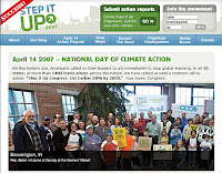
By the way, our Step It Up for Climate Change went very well Saturday, even though we had to bring it inside the City Hall Chambers and out of the pouring rain, rather than hold it outside in the Farmer's Market. Rep. Baron Hill spoke, along with our Mayor, who issued a special proclamation honoring Step It Up. Author Scott Russell Sanders read a very moving 'letter to his children' that brought many in the crowd to tears. Every gathering should have their bard... we had more than one. We also had music! Carrie Newcomer sang, along with the a cappella group Kaia. Many City and Environmental organizations had booths set up all through the City Hall Chambers, and demonstrated many ways that each of us can cut our carbon footprint. Afterwards, many braved the rain and planted trees outside our Public Library.